
Cloud Bay topographic map
Interactive map
Click on the map to display elevation.
About this map
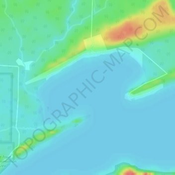
Name: Cloud Bay topographic map, elevation, terrain.
Average elevation: 190 m
Minimum elevation: 179 m
Maximum elevation: 240 m
Other topographic maps
Click on a map to view its topography, its elevation and its terrain.
Ward Lake
Canada > Ontario > Thunder Bay District > Neebing
Ward Lake, Neebing, Thunder Bay District, Northwestern Ontario, Ontario, Canada
Average elevation: 289 m
Cloud Lake
Canada > Ontario > Thunder Bay District > Neebing
Cloud Lake, Neebing, Thunder Bay District, Northwestern Ontario, Ontario, Canada
Average elevation: 367 m