
Thank you for supporting this site ❤️
Make a donation
Make a donation
Gear up for your next adventure:
As an Amazon Associate, this site earns from qualifying purchases at no extra cost to you.
Lilongwe topographic map
Click on the map to display elevation.
Thank you for supporting this site ❤️
Make a donation
Make a donation
Gear up for your next adventure:
As an Amazon Associate, this site earns from qualifying purchases at no extra cost to you.
About this map
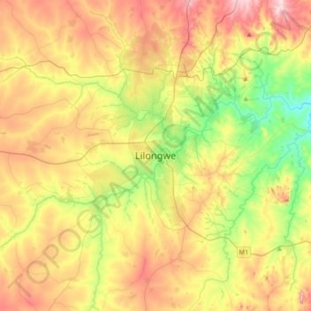
Name: Lilongwe topographic map, elevation, terrain.
Location: Lilongwe, Central Region, P.BAG 781, Malawi (-14.14751 33.60814 -13.82751 33.92814)
Average elevation: 1,102 m
Minimum elevation: 963 m
Maximum elevation: 1,269 m
Thank you for supporting this site ❤️
Make a donation
Make a donation
Gear up for your next adventure:
As an Amazon Associate, this site earns from qualifying purchases at no extra cost to you.