
Camden topographic map
Interactive map
Click on the map to display elevation.
About this map
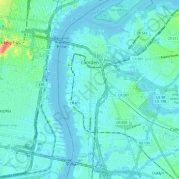
Name: Camden topographic map, elevation, terrain.
Location: Camden, Camden County, New Jersey, United States (39.89866 -75.13639 39.96948 -75.06655)
Average elevation: 7 m
Minimum elevation: -10 m
Maximum elevation: 52 m
Other topographic maps
Click on a map to view its topography, its elevation and its terrain.