
Thank you for supporting this site ❤️
Make a donation
Make a donation
Gear up for your next adventure:
As an Amazon Associate, this site earns from qualifying purchases at no extra cost to you.
Tyfors topographic map
Click on the map to display elevation.
Thank you for supporting this site ❤️
Make a donation
Make a donation
Gear up for your next adventure:
As an Amazon Associate, this site earns from qualifying purchases at no extra cost to you.
About this map
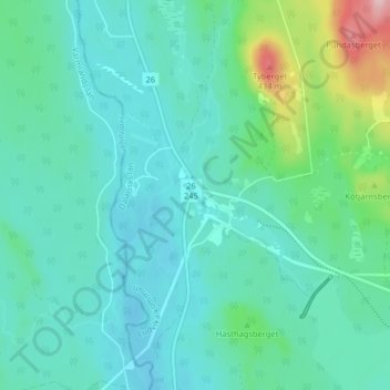
Name: Tyfors topographic map, elevation, terrain.
Location: Tyfors, Ludvika kommun, Dalecarlia, 77010, Sweden (60.13426 14.19192 60.17426 14.23192)
Average elevation: 268 m
Minimum elevation: 224 m
Maximum elevation: 466 m
Thank you for supporting this site ❤️
Make a donation
Make a donation
Gear up for your next adventure:
As an Amazon Associate, this site earns from qualifying purchases at no extra cost to you.