
Thank you for supporting this site ❤️
Make a donation
Make a donation
Gear up for your next adventure:
As an Amazon Associate, this site earns from qualifying purchases at no extra cost to you.
Vérossaz topographic map
Click on the map to display elevation.
Thank you for supporting this site ❤️
Make a donation
Make a donation
Gear up for your next adventure:
As an Amazon Associate, this site earns from qualifying purchases at no extra cost to you.
About this map
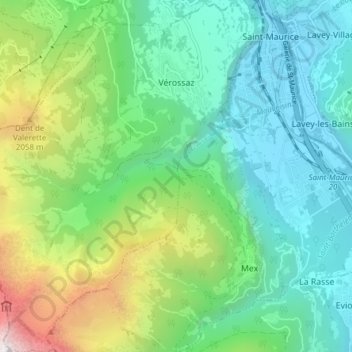
Name: Vérossaz topographic map, elevation, terrain.
Location: Vérossaz, Saint-Maurice, Valais/Wallis, 1891, Switzerland (46.17249 6.94023 46.22521 7.00314)
Average elevation: 1,140 m
Minimum elevation: 406 m
Maximum elevation: 3,123 m
Thank you for supporting this site ❤️
Make a donation
Make a donation
Gear up for your next adventure:
As an Amazon Associate, this site earns from qualifying purchases at no extra cost to you.