
Kalga topographic map
Interactive map
Click on the map to display elevation.
About this map
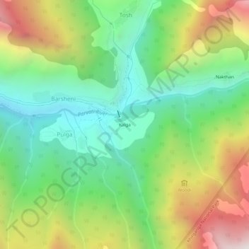
Name: Kalga topographic map, elevation, terrain.
Location: Kalga, Pulga, Kullu, Himachal Pradesh, India (31.97679 77.43167 32.01679 77.47167)
Average elevation: 2,622 m
Minimum elevation: 2,064 m
Maximum elevation: 3,551 m