
Shelter Cove topographic map
Interactive map
Click on the map to display elevation.
About this map
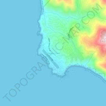
Name: Shelter Cove topographic map, elevation, terrain.
Location: Shelter Cove, Humboldt County, California, United States (40.01042 -124.09309 40.05042 -124.05309)
Average elevation: 66 m
Minimum elevation: 0 m
Maximum elevation: 504 m