
Lai Châu topographic map
Interactive map
Click on the map to display elevation.
About this map
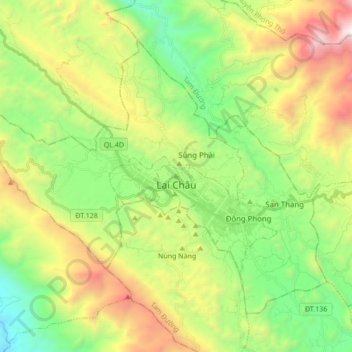
Name: Lai Châu topographic map, elevation, terrain.
Location: Lai Châu, Vietnam (22.34127 103.35027 22.44172 103.52617)
Average elevation: 1,151 m
Minimum elevation: 362 m
Maximum elevation: 2,950 m
Other topographic maps
Click on a map to view its topography, its elevation and its terrain.