
Brdy topographic map
Interactive map
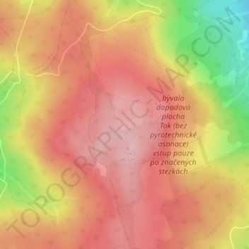
Click on the map to display elevation.
About this map
Name: Brdy topographic map, elevation, terrain.
Average elevation: 794 m
Minimum elevation: 653 m
Maximum elevation: 867 m
Brdy is a range of hills in the Czech Republic, forming a long massif stretching for cca.60 km southwest from Prague. The northern section of the Brdy is called "Hřebeny" and features one narrow ridge (highest elevation Písek - 690m). The main Brdy range starts south of the Litavka river gorge and consists of several major elevations connected into one plateau, the highest peaks among them being Tok (864m), Praha (862m) or Třemšín (827m). Most of the Brdy is covered by forest, and it is one of the largest contiguously forested areas in the interior of the country. Large sections of the massif are designated as a restricted military area and closed to the public. The Brdy military area has been a source of controversy for several decades.
Other topographic maps
Click on a map to view its topography, its elevation and its terrain.
Brdy
Czechia > Central Bohemia > Obecnice
Brdy, Obecnice, okres Příbram, Central Bohemia, Czechia
Average elevation: 782 m