
Moroto topographic map
Interactive map
Click on the map to display elevation.
About this map
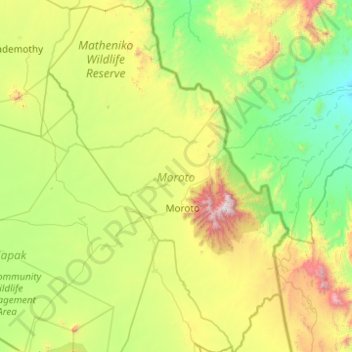
Name: Moroto topographic map, elevation, terrain.
Location: Moroto, Northern Region, Uganda (2.12524 34.28075 3.11037 34.95498)
Average elevation: 1,239 m
Minimum elevation: 678 m
Maximum elevation: 3,000 m
Other topographic maps
Click on a map to view its topography, its elevation and its terrain.