
Dong Nai Province topographic map
Interactive map
Click on the map to display elevation.
About this map
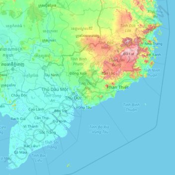
Name: Dong Nai Province topographic map, elevation, terrain.
Location: Dong Nai Province, Vietnam (8.44632 104.63218 13.56632 109.75218)
Average elevation: 110 m
Minimum elevation: -3 m
Maximum elevation: 2,346 m
Other topographic maps
Click on a map to view its topography, its elevation and its terrain.
Long Khánh City
Long Khánh City, Đồng Nai Province, Vietnam
Average elevation: 160 m
Bien Hoa
Vietnam > Dong Nai province > Bien Hoa
Bien Hoa, Bien Hoa City, Dong Nai province, 81000, Vietnam
Average elevation: 24 m