
High Rolls topographic map
Interactive map
Click on the map to display elevation.
About this map
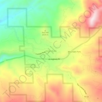
Name: High Rolls topographic map, elevation, terrain.
Location: High Rolls, Otero County, New Mexico, 88325, USA (32.93092 -105.85554 32.97092 -105.81554)
Average elevation: 2,036 m
Minimum elevation: 1,756 m
Maximum elevation: 2,322 m