
Sô-Ava topographic map
Interactive map
Click on the map to display elevation.
About this map
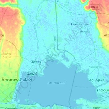
Name: Sô-Ava topographic map, elevation, terrain.
Location: Sô-Ava, Atlantique Department, Benin (6.38504 2.37834 6.64047 2.49486)
Average elevation: 9 m
Minimum elevation: -4 m
Maximum elevation: 67 m
Other topographic maps
Click on a map to view its topography, its elevation and its terrain.
Ganvié
Benin > Atlantique Department > Sô-Ava
Ganvié, Sô-Ava, Atlantique Department, Benin
Average elevation: 4 m