
Manhattan topographic map
Interactive map
Click on the map to display elevation.
About this map
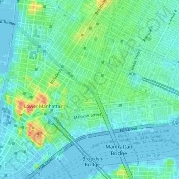
Name: Manhattan topographic map, elevation, terrain.
Average elevation: 12 m
Minimum elevation: -7 m
Maximum elevation: 47 m
Other topographic maps
Click on a map to view its topography, its elevation and its terrain.
Liberty Island
United States of America > New York > New York
Liberty Island, Manhattan Community Board 1, Manhattan, New York County, New York, Stone Street Historic District, New York, United States of America
Average elevation: 0 m
Todt Hill
United States of America > New York > New York
Todt Hill, Staten Island, New York, Richmond County, New York, 10304, United States of America
Average elevation: 75 m
Wards Island
United States of America > New York > New York
Wards Island, Manhattan Community Board 11, Manhattan, New York County, New York, 11102, United States of America
Average elevation: 35 m