
Brión topographic map
Interactive map
Click on the map to display elevation.
About this map
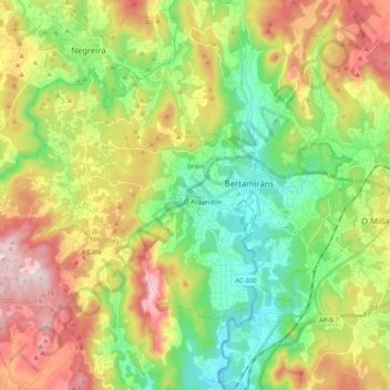
Name: Brión topographic map, elevation, terrain.
Location: Brión, Comarca de Santiago, A Coruña, Galicia, España (42.80667 -8.83088 42.90298 -8.62538)
Average elevation: 238 m
Minimum elevation: 7 m
Maximum elevation: 524 m
Other topographic maps
Click on a map to view its topography, its elevation and its terrain.