
Ammanford topographic map
Interactive map
Click on the map to display elevation.
About this map
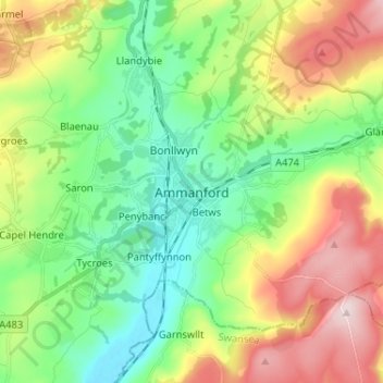
Name: Ammanford topographic map, elevation, terrain.
Location: Ammanford, Carmarthenshire, Wales, SA18 3DL, United Kingdom (51.75263 -4.02877 51.83263 -3.94877)
Average elevation: 142 m
Minimum elevation: 10 m
Maximum elevation: 374 m
Other topographic maps
Click on a map to view its topography, its elevation and its terrain.
Glanamman
United Kingdom > Wales > Carmarthenshire
Glanamman, Carmarthenshire, Wales, SA18 1DJ, United Kingdom
Average elevation: 188 m
Carway
United Kingdom > Wales > Carmarthenshire
Carway, Carmarthenshire, Wales, SA17 4HL, United Kingdom
Average elevation: 75 m
Birds Hill
United Kingdom > Wales > Carmarthenshire > Llandeilo
Birds Hill, Llandeilo, Carmarthenshire, Wales, SA19 6SH, United Kingdom
Average elevation: 53 m