
Indian Island topographic map
Interactive map
Click on the map to display elevation.
About this map
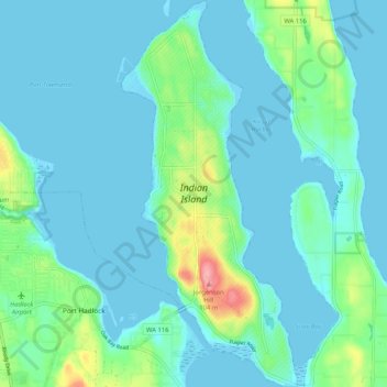
Name: Indian Island topographic map, elevation, terrain.
Location: Indian Island, Jefferson County, Washington, United States (48.01808 -122.74819 48.08721 -122.70125)
Average elevation: 19 m
Minimum elevation: -3 m
Maximum elevation: 113 m
Other topographic maps
Click on a map to view its topography, its elevation and its terrain.
Mount Olympus
United States > Washington > Jefferson County
Mount Olympus, Jefferson County, Washington, United States
Average elevation: 1,934 m