
Güeldres topographic map
Interactive map
Click on the map to display elevation.
About this map
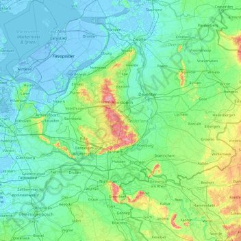
Name: Güeldres topographic map, elevation, terrain.
Location: Güeldres, Países Bajos (51.73358 4.99385 52.52203 6.83280)
Average elevation: 14 m
Minimum elevation: -8 m
Maximum elevation: 108 m
Other topographic maps
Click on a map to view its topography, its elevation and its terrain.