
La Lienne topographic map
Interactive map
Click on the map to display elevation.
About this map
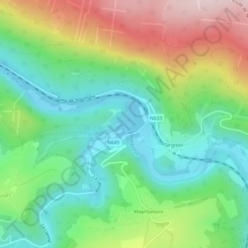
Name: La Lienne topographic map, elevation, terrain.
Location: La Lienne, Stoumont, Verviers, Luik, Wallonië, 4987, België (50.41442 5.77480 50.41454 5.77513)
Average elevation: 300 m
Minimum elevation: 181 m
Maximum elevation: 512 m
Other topographic maps
Click on a map to view its topography, its elevation and its terrain.