
Rawa Mekar Jaya topographic map
Interactive map
Click on the map to display elevation.
About this map
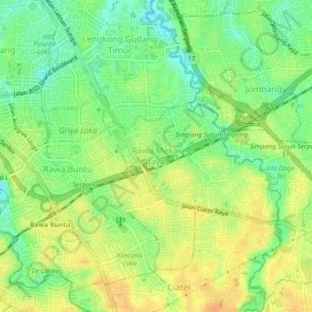
Name: Rawa Mekar Jaya topographic map, elevation, terrain.
Location: Rawa Mekar Jaya, South Tangerang, Banten, 15317, Indonesia (-6.32716 106.66990 -6.28716 106.70990)
Average elevation: 43 m
Minimum elevation: 24 m
Maximum elevation: 59 m