
Çatalca topographic map
Interactive map
Click on the map to display elevation.
About this map
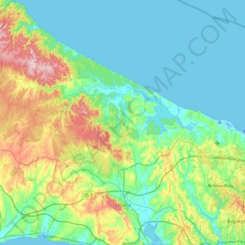
Name: Çatalca topographic map, elevation, terrain.
Location: Çatalca, Istanbul, Marmara Region, Turkey (41.05682 28.07016 41.58503 28.59537)
Average elevation: 84 m
Minimum elevation: -23 m
Maximum elevation: 394 m
Other topographic maps
Click on a map to view its topography, its elevation and its terrain.