
Levis topographic map
Interactive map
Click on the map to display elevation.
About this map
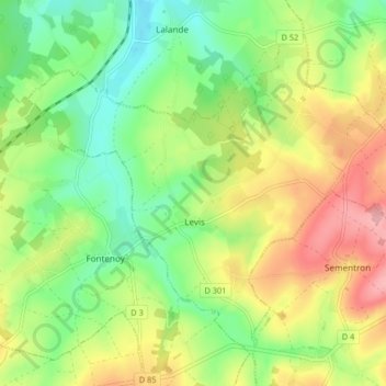
Name: Levis topographic map, elevation, terrain.
Average elevation: 254 m
Minimum elevation: 202 m
Maximum elevation: 325 m
Other topographic maps
Click on a map to view its topography, its elevation and its terrain.
La Petite Cour Batonnerie
France > Bourgogne-Franche-Comté > Yonne > Toucy > La Mine d'Or
Average elevation: 257 m