
Brackendale topographic map
Interactive map
Click on the map to display elevation.
About this map
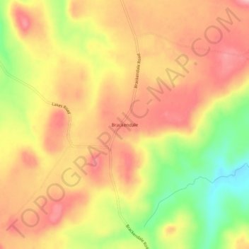
Name: Brackendale topographic map, elevation, terrain.
Location: Brackendale, Walcha Council, New South Wales, Australia (-31.23500 151.68111 -31.19500 151.72111)
Average elevation: 1,255 m
Minimum elevation: 1,167 m
Maximum elevation: 1,311 m