
La Mortera topographic map
Interactive map
Click on the map to display elevation.
About this map
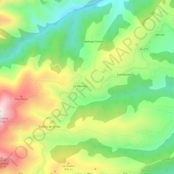
Name: La Mortera topographic map, elevation, terrain.
Location: La Mortera, Asturias, España (43.30306 -6.60083 43.34306 -6.56083)
Average elevation: 689 m
Minimum elevation: 405 m
Maximum elevation: 1,096 m