
Bequia topographic map
Interactive map
Click on the map to display elevation.
About this map
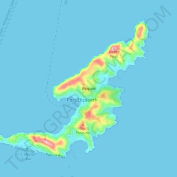
Name: Bequia topographic map, elevation, terrain.
Location: Bequia, Grenadines, Saint Vincent and the Grenadines (12.98450 -61.28692 13.04846 -61.20366)
Average elevation: 16 m
Minimum elevation: -2 m
Maximum elevation: 244 m
Other topographic maps
Click on a map to view its topography, its elevation and its terrain.