
Appalachian topographic map
Interactive map
Click on the map to display elevation.
About this map
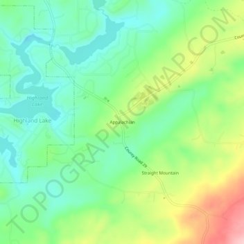
Name: Appalachian topographic map, elevation, terrain.
Location: Appalachian, Blount County, Alabama, United States (33.86482 -86.42193 33.90482 -86.38193)
Average elevation: 324 m
Minimum elevation: 262 m
Maximum elevation: 443 m