
Montgomery County topographic map
Interactive map
Click on the map to display elevation.
About this map
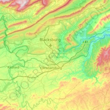
Name: Montgomery County topographic map, elevation, terrain.
Location: Montgomery County, Virginia, United States of America (36.98149 -80.61478 37.36893 -80.17745)
Average elevation: 654 m
Minimum elevation: 342 m
Maximum elevation: 1,318 m
Other topographic maps
Click on a map to view its topography, its elevation and its terrain.