
Greenham topographic map
Interactive map
Click on the map to display elevation.
About this map
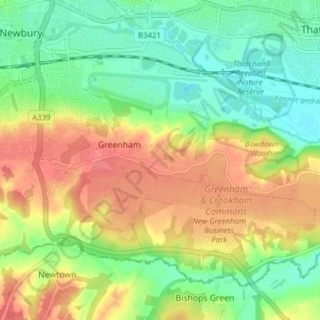
Name: Greenham topographic map, elevation, terrain.
Location: Greenham, West Berkshire, South East, England, United Kingdom (51.36723 -1.33954 51.40171 -1.26925)
Average elevation: 94 m
Minimum elevation: 64 m
Maximum elevation: 130 m