
Octopus Lake topographic map
Interactive map
Click on the map to display elevation.
About this map
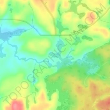
Name: Octopus Lake topographic map, elevation, terrain.
Average elevation: 553 m
Minimum elevation: 518 m
Maximum elevation: 598 m
Other topographic maps
Click on a map to view its topography, its elevation and its terrain.
Sturgeon Lake
United States of America > Minnesota > Sturgeon Lake > Sturgeon Lake
Average elevation: 330 m