
La Guajira topographic map
Interactive map
Click on the map to display elevation.
About this map
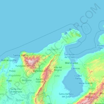
Name: La Guajira topographic map, elevation, terrain.
Location: La Guajira, Colombia (8.71801 -75.17358 13.83801 -70.05358)
Average elevation: 204 m
Minimum elevation: -4 m
Maximum elevation: 5,441 m
Other topographic maps
Click on a map to view its topography, its elevation and its terrain.
Boca Grande
Colombia > La Guajira > Boca Grande
Boca Grande, Riohacha, La Guajira, 44001, Colombia
Average elevation: 10 m