
Rayong Province topographic map
Interactive map
Click on the map to display elevation.
About this map
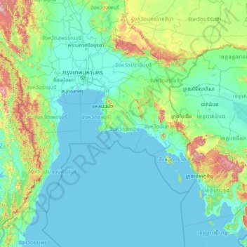
Name: Rayong Province topographic map, elevation, terrain.
Location: Rayong Province, Thailand (10.23437 98.81053 15.35437 103.93053)
Average elevation: 118 m
Minimum elevation: -2 m
Maximum elevation: 1,678 m