
Kalasin topographic map
Interactive map
Click on the map to display elevation.
Kalasin
Most of the province is covered by hilly landscape. The town of Kalasin is at an elevation of 152 m. In the north is the Lam Pao Dam built from 1963-1968. It stores 1,430 million m³ of water for flood prevention and agriculture. The Lam Pao reservoir effectively cuts the northern part of the province in half, but there are car ferries connecting the district of Sahatsakhan in the east with the district Nong Kung Si in the west, saving up to one hour off the journey by road. On the northwestern creek of the reservoir a road bridge connects the village of Ban Dong Bang in the west with the district town of Wang Sam Mo in the east. Although the bridge was constructed several years ago (pre-2000) it is not featured (2006) on any commercially available road maps.
About this map
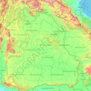
Name: Kalasin topographic map, elevation, terrain.
Location: Kalasin, Thailand (14.03126 101.09255 19.15126 106.21255)
Average elevation: 293 m
Minimum elevation: -1 m
Maximum elevation: 2,629 m