
Ospringe topographic map
Interactive map
Click on the map to display elevation.
About this map
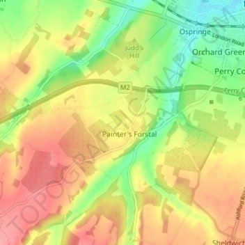
Name: Ospringe topographic map, elevation, terrain.
Location: Ospringe, Swale, Kent, South East, England, United Kingdom (51.27753 0.81866 51.31526 0.88251)
Average elevation: 46 m
Minimum elevation: 3 m
Maximum elevation: 86 m