
Rungwe topographic map
Interactive map
Click on the map to display elevation.
About this map
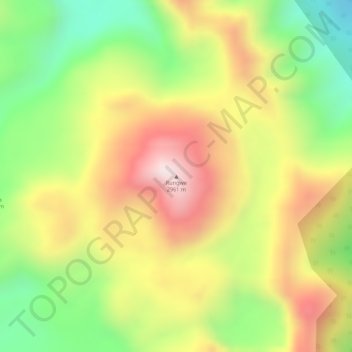
Name: Rungwe topographic map, elevation, terrain.
Location: Rungwe, Mbeya, Southern Highlands Zone, Tanzania (-9.11767 33.66450 -9.11757 33.66460)
Average elevation: 2,636 m
Minimum elevation: 2,371 m
Maximum elevation: 2,880 m