
Malacky topographic map
Interactive map
Click on the map to display elevation.
About this map
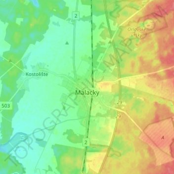
Name: Malacky topographic map, elevation, terrain.
Location: Malacky, District of Malacky, Region of Bratislava, Slovakia (48.39823 16.97761 48.47926 17.05878)
Average elevation: 169 m
Minimum elevation: 144 m
Maximum elevation: 206 m