
Alexandria topographic map
Interactive map
Click on the map to display elevation.
About this map
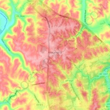
Name: Alexandria topographic map, elevation, terrain.
Location: Alexandria, Campbell County, Kentucky, United States (38.92335 -84.42162 38.99231 -84.33859)
Average elevation: 220 m
Minimum elevation: 140 m
Maximum elevation: 267 m
Other topographic maps
Click on a map to view its topography, its elevation and its terrain.
Mentor
United States > Kentucky > Campbell County
Mentor, Campbell County, Kentucky, United States
Average elevation: 176 m
Aspen Grove
United States > Kentucky > Campbell County > Aspen Grove
Aspen Grove, Campbell County, Kentucky, 41001, United States
Average elevation: 226 m