
Rushen topographic map
Interactive map
Click on the map to display elevation.
About this map
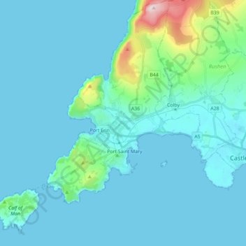
Name: Rushen topographic map, elevation, terrain.
Location: Rushen, Isle of Man (54.03779 -4.83901 54.14006 -4.68573)
Average elevation: 44 m
Minimum elevation: 0 m
Maximum elevation: 434 m