
Lengnau topographic map
Interactive map
Click on the map to display elevation.
About this map
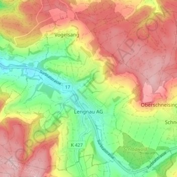
Name: Lengnau topographic map, elevation, terrain.
Location: Lengnau, Bezirk Zurzach, Aargau, 5426, Switzerland (47.50626 8.28894 47.54736 8.35493)
Average elevation: 512 m
Minimum elevation: 393 m
Maximum elevation: 624 m