
Kraljevo topographic map
Interactive map
Click on the map to display elevation.
About this map
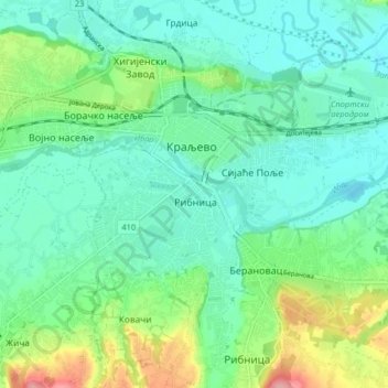
Name: Kraljevo topographic map, elevation, terrain.
Average elevation: 214 m
Minimum elevation: 183 m
Maximum elevation: 302 m
Other topographic maps
Click on a map to view its topography, its elevation and its terrain.
Kraljevo
Serbia > Central Serbia > Kraljevo
Kraljevo, Kraljevo City, Raska Administrative District, Central Serbia, 36000, Serbia
Average elevation: 404 m