
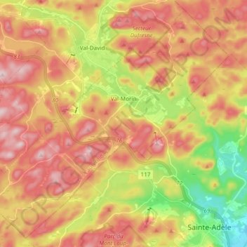
Val-Morin topographic map
Interactive map
Click on the map to display elevation.
About this map
Name: Val-Morin topographic map, elevation, terrain.
Average elevation: 369 m
Minimum elevation: 185 m
Maximum elevation: 520 m
Les Laurentides trails, hiking, mountain biking, running and outdoor activities
Other topographic maps
Click on a map to view its topography, its elevation and its terrain.
Mont Sainte-Agathe
Canada > Quebec > Les Laurentides > Sainte-Agathe-des-Monts
Average elevation: 448 m
Saint-Faustin
Canada > Quebec > Les Laurentides > Saint-Faustin–Lac-Carré > Saint-Faustin-Lac-Carré
Average elevation: 414 m