
Dorset topographic map
Interactive map
Click on the map to display elevation.
About this map
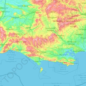
Name: Dorset topographic map, elevation, terrain.
Average elevation: 57 m
Minimum elevation: -2 m
Maximum elevation: 281 m
Other topographic maps
Click on a map to view its topography, its elevation and its terrain.
Talbot Village
United Kingdom > England > Talbot Village
Talbot Village, Bournemouth, Christchurch and Poole, South West England, England, BH10 4JA, United Kingdom
Average elevation: 40 m