
Stikine River topographic map
Interactive map
Click on the map to display elevation.
About this map
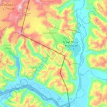
Name: Stikine River topographic map, elevation, terrain.
Location: Stikine River, Wrangell, Alaska, USA (56.64773 -132.21905 56.97886 -131.75103)
Average elevation: 677 m
Minimum elevation: -6 m
Maximum elevation: 2,413 m
Other topographic maps
Click on a map to view its topography, its elevation and its terrain.