
Medel topographic map
Interactive map
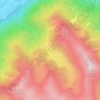
Click on the map to display elevation.
About this map
Name: Medel topographic map, elevation, terrain.
Average elevation: 2,052 m
Minimum elevation: 1,381 m
Maximum elevation: 2,510 m
Other topographic maps
Click on a map to view its topography, its elevation and its terrain.
Eisacktal - Valle Isarco
Italy > Trentino-Alto Adige/Südtirol > South Tyrol
Average elevation: 1,487 m
Etsch - Adige
Italy > Trentino-Alto Adige/Südtirol > South Tyrol > Tarnell - Tarnello > Oberplatz
Average elevation: 1,075 m
Levico Terme
Italy > Trentino-Alto Adige/Südtirol > Provincia di Trento
The town is dominated by the mountains of the Lagorai range on the north, with Monte Fronte, elevation 1,582 metres (5,190 ft), and Monte Panarotta (2,002 metres (6,568 ft)), and the zone of the Plateaus (Vezzena, Lavarone, Luserna, Folgaria) on the south, where Cima Vezzena, also locally called Pizzo di…
Average elevation: 952 m
San Giovanni di Fassa - Sèn Jan
Italy > Trentino-Alto Adige/Südtirol > Provincia di Trento
Average elevation: 2,025 m
Sëlva - Wolkenstein - Selva di Val Gardena
Italy > Trentino-Alto Adige/Südtirol > Sëlva - Wolkenstein - Selva di Val Gardena
Average elevation: 2,145 m
Besenello
Italy > Trentino-Alto Adige/Südtirol > Provincia di Trento > Besenello
Average elevation: 672 m
Klettergarten Hohe Festung (Franzenfeste)
Italy > Trentino-Alto Adige/Südtirol > South Tyrol > Franzensfeste - Fortezza > Obersalcher
Average elevation: 1,048 m
Franzensfeste - Fortezza
Italy > Trentino-Alto Adige/Südtirol > South Tyrol > Franzensfeste - Fortezza
Average elevation: 1,417 m