
Ayagoz District topographic map
Interactive map
Click on the map to display elevation.
About this map
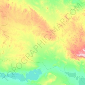
Name: Ayagoz District topographic map, elevation, terrain.
Location: Ayagoz District, East Kazakhstan Region, Kazakhstan (46.77956 76.78336 48.88730 81.67279)
Average elevation: 638 m
Minimum elevation: 335 m
Maximum elevation: 2,337 m
Other topographic maps
Click on a map to view its topography, its elevation and its terrain.