
Roswell topographic map
Interactive map
Click on the map to display elevation.
About this map
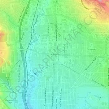
Name: Roswell topographic map, elevation, terrain.
Average elevation: 1,885 m
Minimum elevation: 1,839 m
Maximum elevation: 2,001 m
Other topographic maps
Click on a map to view its topography, its elevation and its terrain.
Glen Eyrie Reservoir
United States of America > Colorado > Colorado Springs > Roswell
Average elevation: 1,992 m