
Mission Peak topographic map
Interactive map
Click on the map to display elevation.
About this map
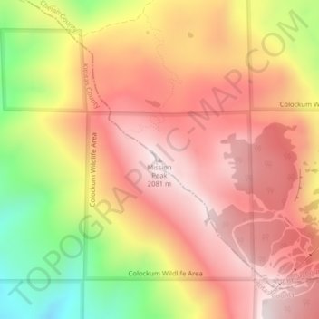
Name: Mission Peak topographic map, elevation, terrain.
Average elevation: 1,829 m
Minimum elevation: 1,430 m
Maximum elevation: 2,079 m
Other topographic maps
Click on a map to view its topography, its elevation and its terrain.
Asotin
United States of America > Washington > Asotin
Asotin is located at 46°20′20″N 117°2′47″W / 46.33889°N 117.04639°W / 46.33889; -117.04639 (46.338847, -117.046441). It is a few miles south of Clarkston, on the west bank of the Snake River. The elevation is 801 feet (244 m) above sea level.
Average elevation: 319 m