
Niamey topographic map
Interactive map
Click on the map to display elevation.
Niamey
The Niamey region straddles between the Liptako, corresponding to the northern extremity of the East ridge of Man, and the south-western edge of the Iullemmeden basin. Covering an area of over 250 km2 (97 sq mi), the metropolitan area sits atop two plateaux reaching 218 m (715 ft) in altitude, bisected by the Niger River. At Niamey, the river, running almost straight SSE from Gao, Mali, makes a series of wide bends. The city grew on the east ("left bank") of the river as it meanders from west to east flow to run almost directly south. A series of marshy islands begin at Niamey and extend south in the river.
About this map
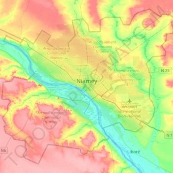
Name: Niamey topographic map, elevation, terrain.
Location: Niamey, Kollo, Niger (13.38296 1.96095 13.64734 2.26424)
Average elevation: 225 m
Minimum elevation: 176 m
Maximum elevation: 273 m