
Hasankeyf topographic map
Interactive map
Click on the map to display elevation.
Hasankeyf
On the 19th of February 2020, the water level reached up to 479.30m elevation and rising. When water level rises above 483m Hasankeyf would be completely under water. By the 1st of April, water levels reached up to the elevation of 498.2m. Almost all of old city is under the water.
About this map
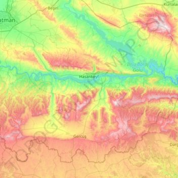
Name: Hasankeyf topographic map, elevation, terrain.
Location: Hasankeyf, Batman, Southeastern Anatolia Region, Turkey (37.62835 41.21144 37.76329 41.82192)
Average elevation: 874 m
Minimum elevation: 438 m
Maximum elevation: 1,516 m