
Sanger topographic map
Interactive map
Click on the map to display elevation.
Sanger
Sanger is a city in Fresno County, California, United States. The population was 24,270 at the 2010 census, up from 18,731 at the 2000 census. Sanger is located 13 miles (21 km) east-southeast of Fresno, at an elevation of 371 feet (113 m).
About this map
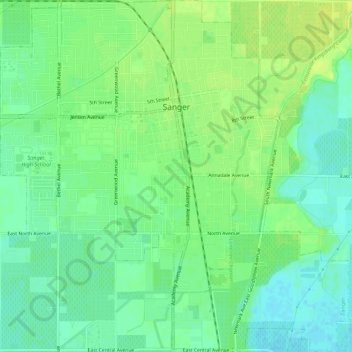
Name: Sanger topographic map, elevation, terrain.
Average elevation: 111 m
Minimum elevation: 102 m
Maximum elevation: 120 m