
Wantagh topographic map
Interactive map
Click on the map to display elevation.
About this map
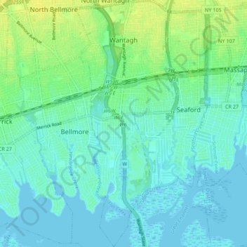
Name: Wantagh topographic map, elevation, terrain.
Average elevation: 6 m
Minimum elevation: -3 m
Maximum elevation: 18 m
Other topographic maps
Click on a map to view its topography, its elevation and its terrain.
Uniondale
United States of America > New York > Hempstead
Uniondale, Hempstead, Nassau County, New York, 11553, United States of America
Average elevation: 20 m